Tropical Storm Chalane is expected in Zimbabwe from tomorrow until Friday.
This would be characterised by heavy rains of more than 50mm in 24 hours expected over high ground along the Eastern Highlands and the main watershed.
The Meteorological Services Department recently warned that there would probably be flash floods in areas of poor drainage, rising rivers and reduced visibility during some sharp downpours.
“Flash flooding in areas of poor drainage as well as along river basins plus mudslides and landslides as well as the collapse of walls, due to excessive moisture, remains probable.
“Tropical Depression Chalane entered the warmer water of the Mozambique Channel where it is expected to re-intensify into a tropical storm similar to Cyclone Dineo. The system should sweep across the country from Wednesday into the New Year.
“These rains should ease off as we get into the weekend,” said the department.
The met department urged the public to keep informed and listen to updates. “Have a contingency plan in place in case of adverse weather.
“Know your escape route to the nearest emergency centre if need be and have emergency numbers close.
“Have a few provisions, first aid kit, torch, essential documents and medication in a waterproof-easy to carry bag or satchel,” said the MSD.
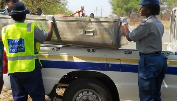
Meanwhile, authorities in Madagascar, Malawi, Mozambique, Zambia and Zimbabwe are on alert and coordinating preparedness activities.
The government of Zimbabwe has since opened evacuation centres:
MANICALAND CYCLONE CHALANE EVACUATION CENTRES:
1-Mapote Primary
2-Chipinge Vocational Training Centre
3-Mapungwana Primary
4-Tamandai Primary
5- Mudzite Primary
6- Chief Gwenzi Homestead
7- Kondo Primary
8- Munoirirwa Primary
9-Murenje Primary
10-Chinaa Secondary
11- Emerald Hill Primary
12- Beacon Hill Primary
13- Mt Selinda High
14-Chiburwe Primary
15- Mbeure Primary
16- Tuzuka Secondary
17- Rimbi High
18- Mazvire Red Cross Rescue
19- Mutezwa Primary
20- Zamuchiya Primary
21-Checheche Primary
22- Madhuku Primary
23- Rimai Primary
24- Chisumbanje Primary
25- Green Fuel Estate
26- Vheneka Primary
27- Garahwa Primary
28- Chinyamukwakwa Primary
29- Maparadze Primary
30- Mahenye Primary
Mahenye Secondary
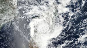
As stated by the RelifWeb, the tropical depression that formed earlier this week in the Indian Ocean intensified on 24 December into Moderate Tropical Storm Chalane. The tropical storm was located about 860 kilometres east of Antalaha District in Madagascar in the afternoon of 24 December and was moving at 17 km/h with an average wind speed of 75 km/h and gusts capping 100 km/h.
The Meteo Madagascar, said Tropical Storm Chalane continued to move westwards and struck the north and centre-east coast of Madagascar on 27 December.
The weather system may eventually emerge over the Mozambique Channel around 29 December and move towards central Mozambique, where Cyclone Idai hit nearly two years ago.
According to Mozambique’s National Institute of Meteorology (INAM), projections indicate that the storm could impact the Mozambican coast on 29 or 30 December, affecting Nampula, Zambezia and Sofala provinces.
After making landfall in Mozambique, the storm could proceed towards Zimbabwe, following a trajectory similar to Cyclone Idai, with Chimanimani District most at-risk according to current predictions.
The Meteorological Services Department is on alert and monitoring the situation.
In Malawi, the Department of Climate Change and Meteorological services released a statement saying that the storm is expected to bring strong winds and high amounts of rainfall which could cause flooding in the country.
-Zwnews